Project files
2 KB
Machine-translated by Robotheca from the original in Chinese (opens in a new tab). License: GPL-3.0-only (opens in a new tab).
GEARdrones
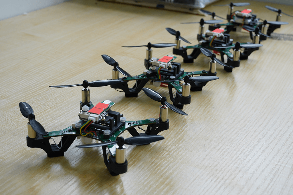
GEARdrones is a quadrotor unmanned aerial vehicle (UAV) system developed specifically for low-cost drone formation control, integrating a flight controller, UWB relative positioning algorithm, and ground control station software.
This project mainly includes the following components:
- Embedded software projects for two versions of flight controllers based on STM32F1 and STM32F4
- Embedded software project for a remote controller based on STM32F1
- Drone PCB projects (being organized) and shell models
- MATLAB simulation files for the relative positioning algorithm
- Ground control station software developed using PYQT5 and MQTT
Reference Development Environment:
Embedded software development environment: Keil MDK5 5.29
Compiler: Arm Compiler V5.06 build750
MQTT server: mosquito/EMQX
MATLAB 2022B
Python 3.8
References:
[1] Guo K, Xie L. INFRASTRUCTURE-FREE COOPERATIVE RELATIVE LOCALIZATION FOR UAVS IN GPS-DENIED ENVIRONMENTS[J]. International Journal of Robotics and Automation, 2021, 36(6).
[2] Nguyen T M, Zaini A H, Guo K, et al. An ultra-wideband-based multi-UAV localization system in GPS-denied environments[C]//2016 International Micro Air Vehicles Conference. 2016, 6: 1-15.
[3] Guo K, Qiu Z, Miao C, et al. Ultra-wideband-based localization for quadcopter navigation[J]. Unmanned Systems, 2016, 4(01): 23-34.
[4] Guo K, Li X, Xie L. Ultra-wideband and odometry-based cooperative relative localization with application to multi-UAV formation control[J]. IEEE transactions on cybernetics, 2019, 50(6): 2590-2603.
Reference Open Source Libraries:
SRML: SCUT Tiger Embedded Software Middleware Layer Library (opens in a new tab)
Files by @Excitablecell, at commit 4890019, read from GitHub in your browser. Hardware license: GPL-3.0-only; software license: GPL-3.0-only. Robotheca doesn't review code: read it before running it.